
Hidden for Thousands of Years? NASA and ISRO’s New Satellite Reveals a Giant Bird-Shaped Mystery in Antarctica
Hidden for Thousands of Years? NASA and ISRO’s New Satellite Reveals a Giant Bird-Shaped Mystery in Antarctica One of the world’s newest Earth-observation satellites has already captured global attention. The NASA-ISRO Synthetic Aperture Radar (NISAR) mission has released one of its earliest radar images—and among the most striking features is what appears to be a...
TheBusinessNow
Jul 23, 2026 · 3 min Read
Key Highlights
- 🛰️ NASA and ISRO's NISAR satellite has released one of its first radar images, revealing a giant bird-shaped feature in East Antarctica.
- ❄️ The "Hummingbird" is not a hidden creature or lost civilization, but a naturally occurring geological and glacial formation highlighted by advanced radar imaging.
- 🌍 NISAR is a joint NASA–ISRO Earth observation mission valued at approximately $1.5 billion, designed to monitor Earth's changing surface with unprecedented precision.
- 📡 Unlike optical satellites, Synthetic Aperture Radar (SAR) allows NISAR to collect data day or night and through clouds, rain, smoke, and darkness.
- 🌊 Scientists believe the mission will significantly improve monitoring of glacier movement, sea-level rise, earthquakes, volcanoes, landslides, forests, and agricultural changes.
- 🤝 The mission represents one of the largest scientific collaborations between NASA and ISRO, combining advanced U.S. radar technology with Indian space engineering.
Hidden for Thousands of Years? NASA and ISRO’s New Satellite Reveals a Giant Bird-Shaped Mystery in Antarctica
One of the world’s newest Earth-observation satellites has already captured global attention.
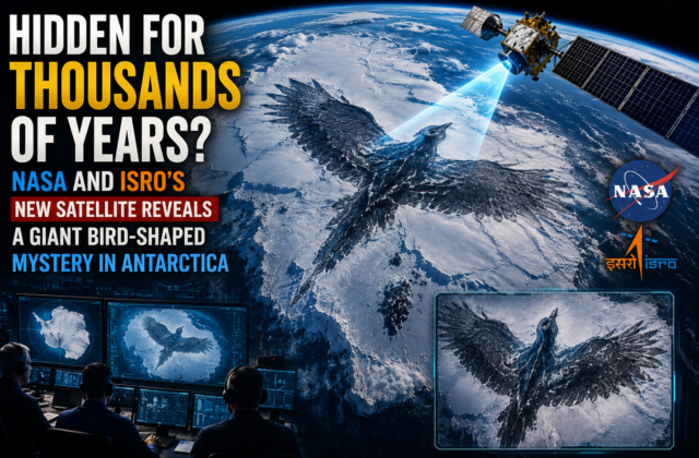
The NASA-ISRO Synthetic Aperture Radar (NISAR) mission has released one of its earliest radar images—and among the most striking features is what appears to be a giant hummingbird-shaped pattern hidden within the icy landscape of East Antarctica.
At first glance, the image looks almost unreal. A massive bird-like outline stretches across the frozen terrain, sparking curiosity online and prompting headlines around the world.
But this is not an archaeological discovery, a hidden civilization, or a giant creature frozen beneath the ice.
Instead, it is a remarkable demonstration of what one of the most advanced Earth-observation satellites ever built can reveal about our planet.
What Is the “Hummingbird” in Antarctica?
The so-called “Hummingbird” is a naturally occurring landscape pattern visible in NISAR’s radar imagery.
Different geological formations, ice structures, mountains, glaciers, and radar reflections combine to create an image that resembles a giant bird when viewed from space.
Scientists describe this as pareidolia—the human tendency to recognize familiar shapes in random natural patterns.
Similar examples include:
- The “Face on Mars”
- Animal-shaped cloud formations
- Rock formations resembling human figures
The Antarctic hummingbird is another fascinating example, but the real scientific value lies in the radar technology that made it visible.
Meet NISAR: The $1.5 Billion Earth Observer
NISAR is one of the most ambitious space collaborations ever undertaken by NASA and the Indian Space Research Organisation (ISRO).
The mission combines expertise from both agencies to create a satellite capable of monitoring Earth’s changing surface with exceptional precision.
Mission Highlights
- 🛰 Joint mission by NASA and ISRO
- 💰 Estimated mission cost of approximately $1.5 billion
- 🌍 Designed to monitor nearly all of Earth’s land and ice surfaces
- 📡 Uses advanced Synthetic Aperture Radar (SAR)
- 📅 Planned mission life of at least three years
Unlike conventional optical satellites, NISAR can collect data day or night and even through clouds, smoke, rain, and darkness.
That capability makes it especially valuable for observing regions such as Antarctica, where harsh weather and long periods of darkness often limit traditional satellite imaging.
Why Antarctica Matters
Antarctica stores approximately 70% of the world’s fresh water in the form of ice.
Even relatively small changes in Antarctic glaciers can influence:
- Global sea levels
- Ocean circulation
- Climate systems
- Coastal flooding risks
- Weather patterns worldwide
Monitoring these changes accurately has become increasingly important for climate science.
What Makes NISAR Different?
Traditional satellite images show what Earth’s surface looks like.
Radar satellites reveal how Earth’s surface is changing.
NISAR can detect movements as small as a few centimeters, allowing scientists to monitor:
- Glacier movement
- Ice-sheet deformation
- Earthquakes
- Landslides
- Volcanoes
- Forest changes
- Ground subsidence
- Agricultural conditions
The “Hummingbird” image is therefore more than an interesting visual—it demonstrates the mission’s ability to detect surface characteristics that conventional imaging often cannot.
Why Scientists Are Excited
The excitement surrounding NISAR extends far beyond Antarctica.
Its data will help researchers improve understanding of:
Climate Change
Scientists will track how quickly glaciers and ice sheets are changing.
Natural Disasters
The satellite can monitor earthquake zones, volcanic regions, landslides, and areas vulnerable to flooding.
Agriculture
Radar observations can help estimate crop conditions, soil moisture, and drought impacts.
Forest Monitoring
NISAR will assist in measuring forest biomass, deforestation, and ecosystem changes.
Infrastructure
Engineers can identify slow ground movement that may affect roads, bridges, dams, and cities.
The Science Behind the Radar
NISAR carries two complementary radar systems:
- L-band SAR, contributed by NASA, which penetrates vegetation and provides information about forests, ice, and ground movement.
- S-band SAR, contributed by ISRO, which offers additional sensitivity to surface features and environmental changes.
By combining these radar frequencies, scientists gain a more detailed understanding of Earth’s surface than would be possible with either system alone.
Why This Matters Beyond Antarctica
The mission is expected to benefit millions of people worldwide.
Potential applications include:
- Better disaster preparedness
- Improved climate models
- More efficient farming
- Water resource management
- Infrastructure monitoring
- Environmental conservation
- Scientific research
Rather than focusing on a single discovery, NISAR will produce continuous global observations that can support decision-making across multiple sectors.
Social Media vs Scientific Reality
Images like the Antarctic “Hummingbird” naturally generate excitement online.
Some posts have speculated about hidden structures or ancient mysteries beneath the ice.
However, there is no evidence that the bird-shaped feature represents an artificial object or unknown civilization.
The appearance results from the interaction of radar imaging with natural geological and glacial features.
The real achievement is the satellite’s ability to reveal these patterns with unprecedented clarity.
A New Era for Earth Observation
NISAR represents a milestone in international cooperation.
NASA contributes decades of radar technology experience, while ISRO provides launch capabilities and advanced radar engineering.
Together, the mission is expected to produce one of the most comprehensive datasets ever collected on Earth’s changing surface.
Over the coming years, scientists anticipate that NISAR will improve understanding of climate change, natural hazards, ecosystems, and environmental processes across the globe.
Final Analysis
The giant bird-shaped feature revealed in East Antarctica has captured public imagination, but the greatest story is not the shape itself—it is the technology behind it.
NISAR’s advanced radar systems allow scientists to observe Earth’s surface with remarkable detail, even in regions where traditional satellites struggle to operate. The mission’s ability to monitor glaciers, forests, earthquakes, and changing landscapes could make it one of the most important Earth-science projects of the decade.
The “Hummingbird” is therefore best viewed not as a mystery waiting to be solved, but as a powerful reminder of how modern space technology continues to reveal our planet in entirely new ways.
❓FAQs
1. What is the “Hummingbird” discovered in Antarctica?
The “Hummingbird” is a bird-shaped natural geological pattern captured by the NASA-ISRO NISAR satellite. It is not a living organism, archaeological structure, or hidden civilization.
2. What is NISAR?
NISAR (NASA-ISRO Synthetic Aperture Radar) is a joint Earth observation satellite developed by NASA and ISRO to monitor changes in Earth’s land, ice sheets, forests, and ecosystems using advanced radar technology.
3. Why is the NISAR mission important?
NISAR will help scientists:
- 🌍 Monitor climate change
- ❄️ Measure glacier movement
- 🌊 Study sea-level rise
- 🌋 Track volcanoes and earthquakes
- 🌳 Monitor forests and ecosystems
- 🌾 Improve agricultural planning
- 🚨 Strengthen disaster preparedness
4. Why can NISAR see features that other satellites cannot?
NISAR uses Synthetic Aperture Radar (SAR), which can collect high-resolution data through clouds, heavy rain, smoke, and even during nighttime, unlike traditional optical satellites.
5. Why is Antarctica important for climate research?
Antarctica contains roughly 70% of Earth’s freshwater in the form of ice. Changes in its glaciers and ice sheets can significantly affect global sea levels, weather systems, and ocean circulation.
6. Is the “Hummingbird” proof of a hidden civilization?
No. Scientists explain that the shape results from natural geological formations and radar reflections. There is no evidence that it represents a man-made structure or an undiscovered civilization.
7. How will NISAR benefit people around the world?
The satellite’s data will support:
- Disaster response
- Climate research
- Water resource management
- Infrastructure monitoring
- Crop forecasting
- Environmental conservation
- Scientific research
8. What makes NASA and ISRO’s partnership significant?
The NISAR mission combines NASA’s expertise in radar technology with ISRO’s satellite engineering and launch capabilities, making it one of the most ambitious international Earth-observation projects ever undertaken.
Keep reading
Related Articles
 Crypto
₿ Bitcoin Breaks Above $72,000: Why Trump’s Crypto Push Is Sending Crypto Stocks Higher
Bitcoin’s $72,000 Move Is Bigger Than Bitcoin A typical crypto headline would be: Bitcoin jumps above $72,000. But that misses the most important part of today’s move. The interesting part is the simultaneous rally in: Bitcoin ↓ Coinbase ↓ Strategy ↓ Circle ↓ Robinhood ↓ Bitcoin miners ↓ Crypto infrastructure That tells us investors aren’t...
 Commodities
Oil Nears $95: Could the Iran War Trigger a New U.S. Inflation Shock?
Oil at $95 Is Not the Real Story A crude-oil headline is easy to write: “Oil prices rise as Iran tensions escalate.” Reuters, Bloomberg, CNBC and WSJ can publish that story within minutes. But for TheBusinessNow, that isn’t enough. The bigger question is: What happens to the American economy if oil stays near $95 —...
 Economy
U.S. National Debt Hits $40 Trillion: Why Treasury Yields Are Rising Again
The $40 Trillion Number Is Not the Whole Story The United States has crossed a psychological and financial milestone. $40 trillion. But simply writing “America owes $40 trillion” misses the more important story. The real question for markets is: Who is willing to finance America’s growing debt — and at what interest rate? That question...
Comments (0)